
Retro Perspective: Panoramic Vistas of Westport Past
 An exhibition of historical images pieced together and enlarged to create new perspectives on Westport’s 19th century landscape. This exhibition was on view at the Westport Public Library January 2 – February 28, 2023.
Click on the images to enlarge.
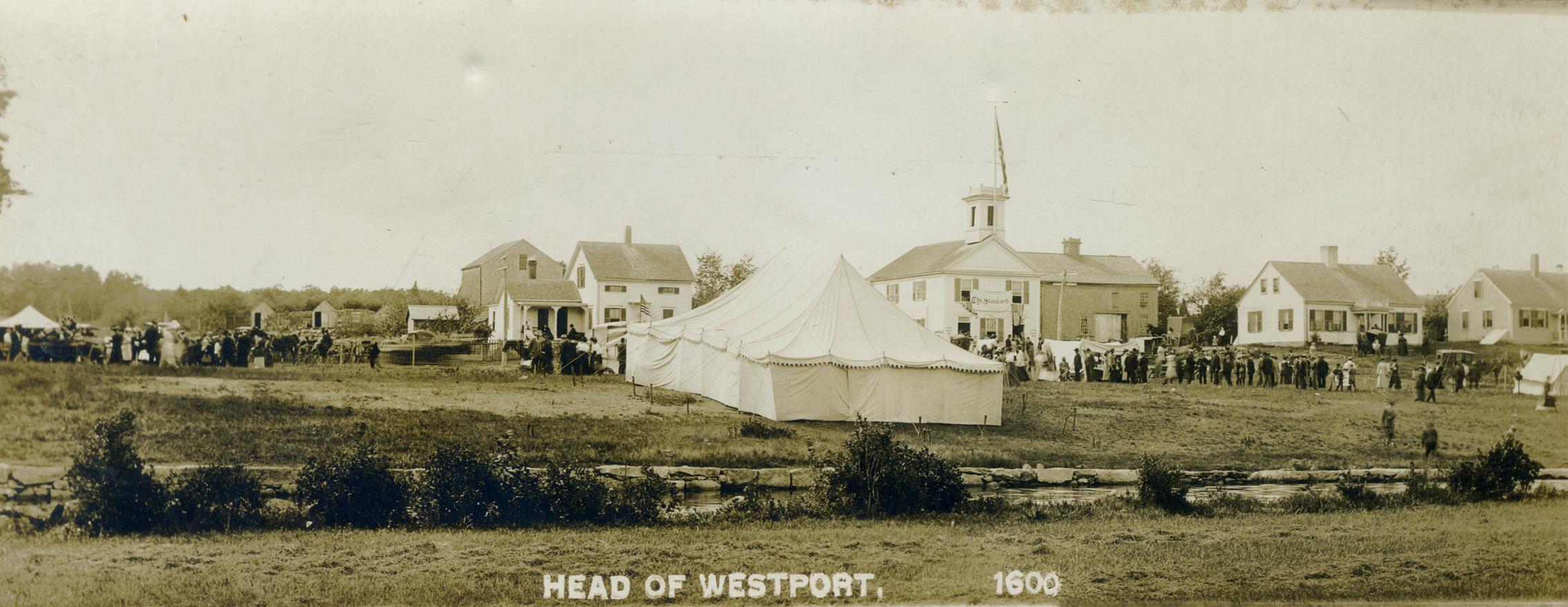
Celebrations at the Head of Westport
In the early 1900’s, the Head of Westport became an important location for community events. In 1908, Dr. Burt organized the first Old Home Week here at the Head. The four-day event included a Religious Day, Historical Day, Educational Day and Carnival Day.
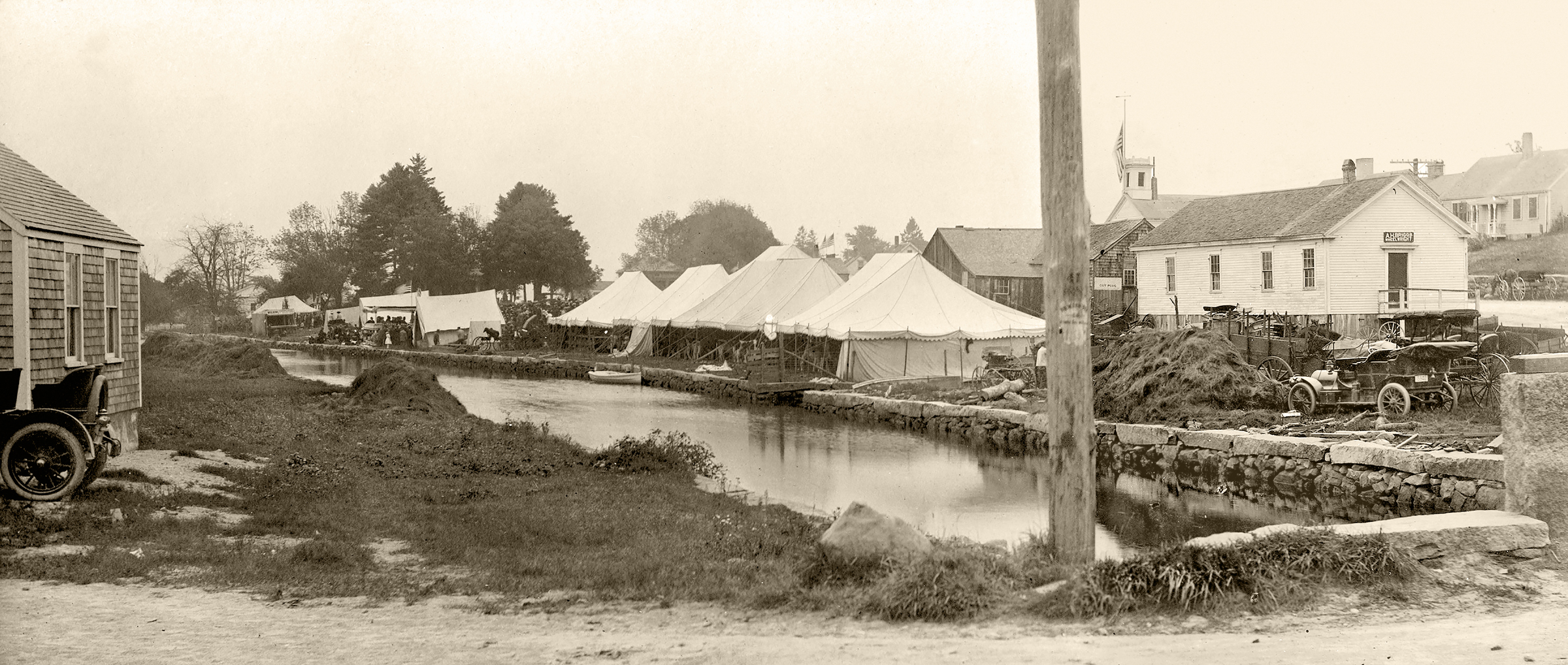
A View of Tents on the Landing at the Head of Westport. Taken in the early 1900’s, this image captures the busy atmosphere at the Head of Westport. The town landing along the river was used for town celebrations such as Old Home Week and the annual agricultural fair. The scene is in stark contrast to the tranquil town landing that we know today – a place for quiet picnics and yoga! In this scene, people and animals crowd under tents lining the riverbank on the west landing. The image hints at the coming of the modern era of transportation—impressively large automobiles contrast with horse-drawn wagons seen in the background. Heaped mounds of salt hay, utilized for forage and for bedding for animals, line the banks of the river. Several buildings appear on the landing including, in the foreground, A.H. Brigg’s wheelwright shop.
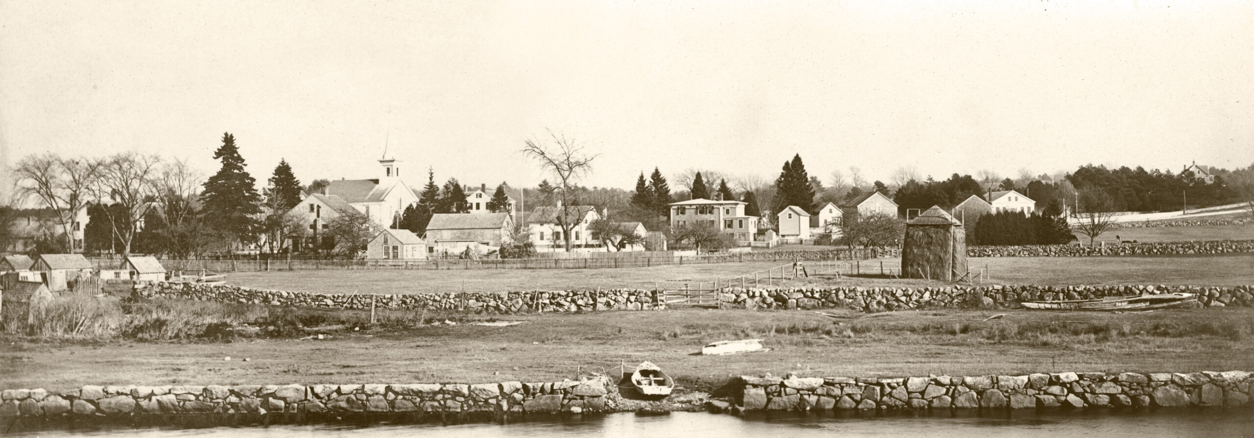
A View of the Head of Westport Looking East to Old County Road. This view, taken from the banks of the Westport River, looks across to the spire of the Pacific Union Church and to an Italianate-style house, with distinctive arched windows, still standing today at 533 Old County Road. The landscape is dotted with small outbuildings and barns. By the early 1900’s, the Head of Westport had completed its transformation from a busy working riverfront for shipbuilding, maritime trade and small-scale mills, turning instead into a prosperous home for retired sea captains.
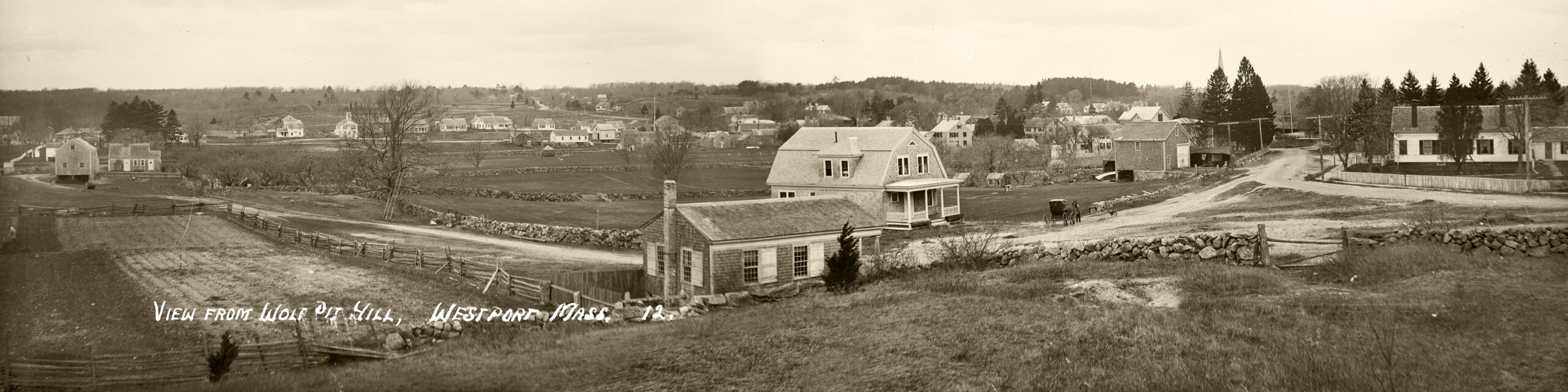
View from Wolf Pit Hill Looking West to Drift Road Image courtesy The Penobscot Marine Museum Collection, Eastern Illustrating and Publishing Company Collection. In the far distance stands the Bell School and houses lining Drift Road. The Wolf Pit School (built in 1833) with its wide white shutters appears in the center foreground, close to the gambrel-roofed house built by W. F. King. On the far right stands the home of Dr. Tupper who cared for seriously ill patients. Several buildings stand on the west landing across the river.

A View Looking East on Old County Road to Pine Hill Road Taken approximately from the present location of the Westport library, this early 20th- century winter scene of the Head of Westport reveals the gently undulating landscape of cleared fields, delineated by stone walls and fences. A large two-story building stands behind the present site of the Westport River Watershed Alliance headquarters. Built by Jeremiah Thompson, it housed a carriage shop.
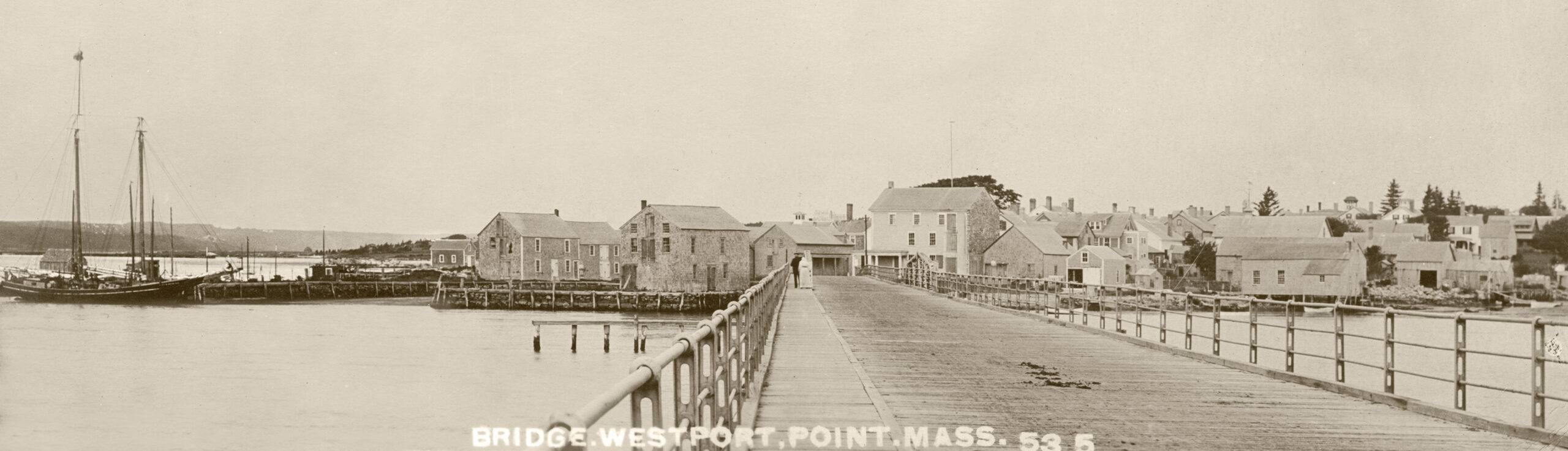
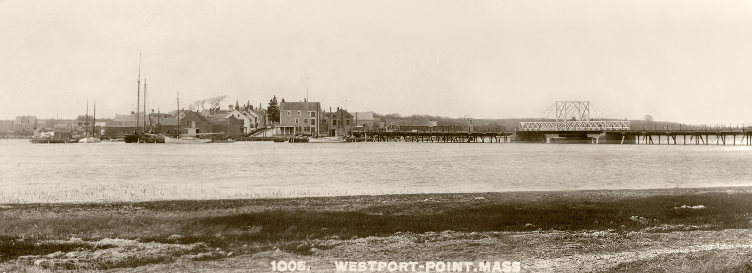
Westport Point Bridge. The Point Bridge was completed in 1894. The bridge rotated to “open” for vessels traveling the East Branch of the Westport River. Four-to-six men walked in a circle pushing a long wooden pole attached to a metal key to operate the gear system which swung the “draw” span open. However, as traffic jams plagued the Point and with the construction of Route 88, the bridge was torn down in 1963. The Point, a pristine historic district, has since become a secluded and sought-after location to live.
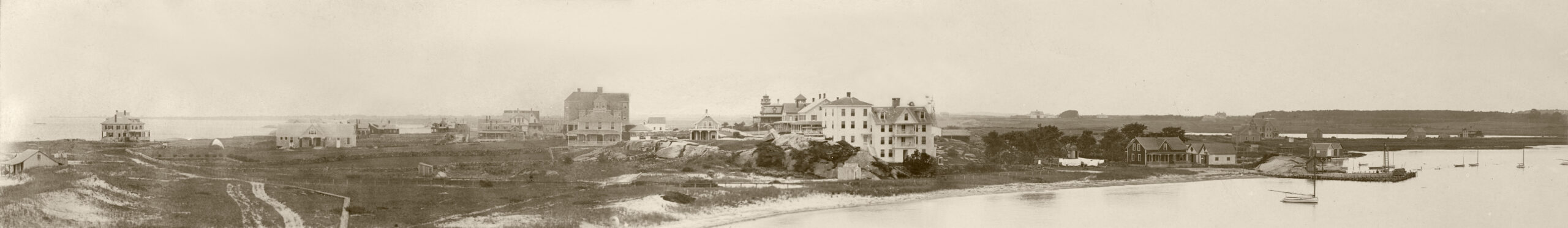
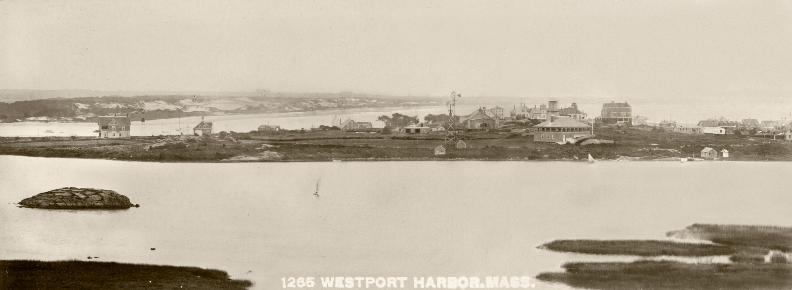
View of Westport Harbor from the Knubble. This is a rare view of Westport Harbor (Acoaxet) dating from the early 1900’s. Grand mansions dot the treeless, rural landscape, marking the beginnings of this remote community as a haven for wealthy Fall River mill owners and businessmen. Today this is the site of the elegant Charlton mansion and surrounding estate. In the center of the image, perched at the mouth of the Westport River, appears Sowle’s Hotel. Built in 1873, it was a local landmark and a magnet for summer visitors, who were drawn by the excellent striped bass fishing. In 1912, the hotel was demolished by E. P. Charlton to make way for his mansion.
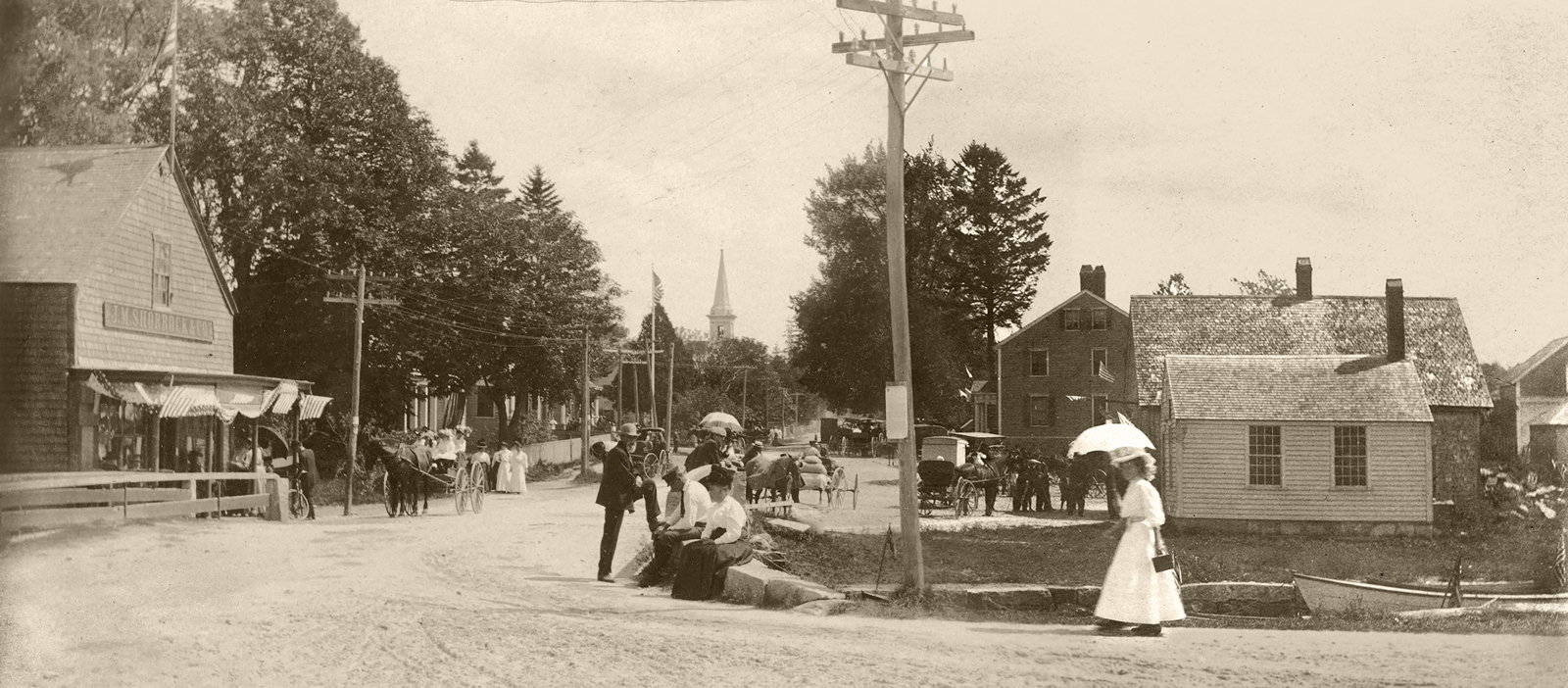
A View of the Bridge at the Head of Westport A festive and busy scene at the Head of Westport, probably taken during one of the many community fairs. Under the shade of a parasol, a woman walks towards the bridge and to the store owned by J.M. Shorrock. Boats are moored along the river bank. Horse-drawn wagons of all shapes and sizes carry people and goods.

View from Wolf Pit Hill Looking West to Drift Road Image courtesy The Penobscot Marine Museum Collection, Eastern Illustrating and Publishing Company Collection. In the far distance stands the Bell School and houses lining Drift Road. The Wolf Pit School (built in 1833) with its wide white shutters appears in the center foreground, close to the gambrel-roofed house built by W. F. King. On the far right stands the home of Dr. Tupper who cared for seriously ill patients. Several buildings stand on the west landing across the river.
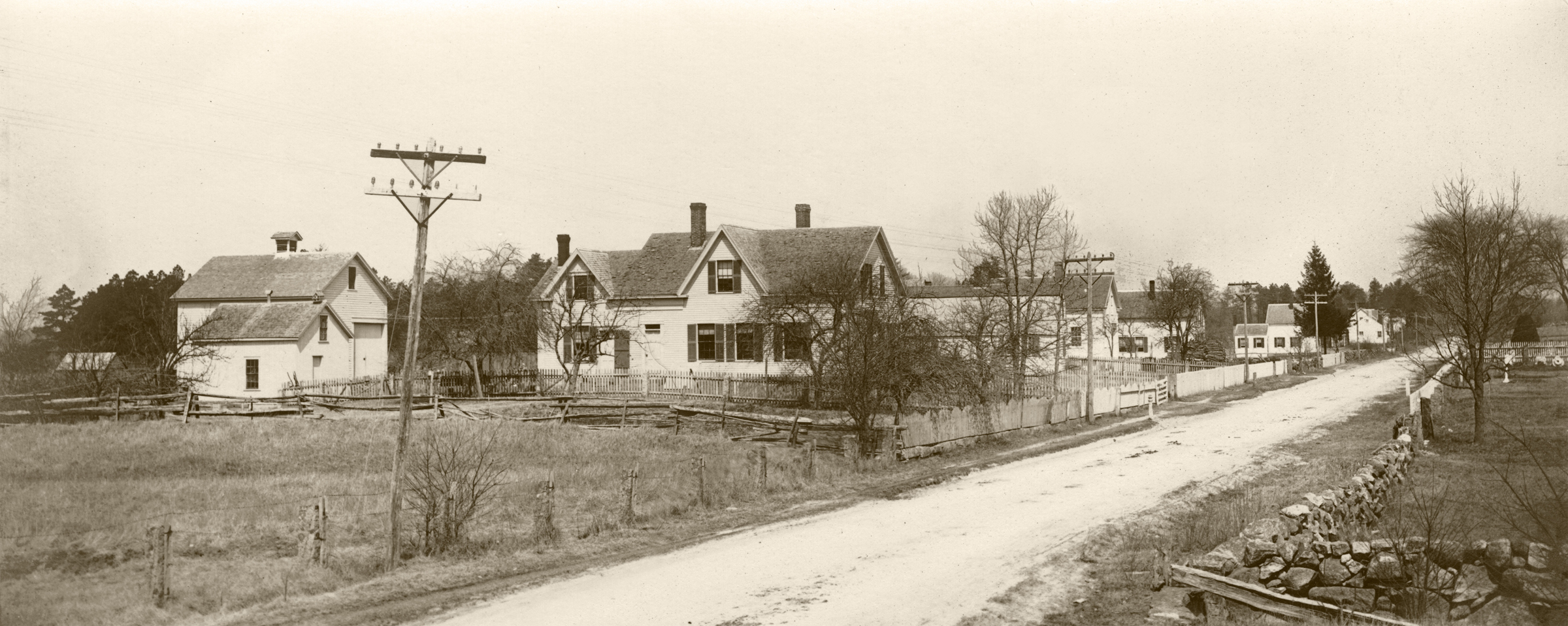
A View Looking North Along Reed Road Near the Head of Westport A view of Reed Road showing the house (and barn) built in 1858 by Captain Weston Tripp, a retired whaling master. This was also the home of Norman Hopkinson, Chief of Police 1926-1938. According to Norman Hopkinson, the police headquarters were located in the front of the house while, at the back of the house, captured booze was stored and used as antifreeze for their automobiles. The Linden Grove and Maple Grove cemetery fence can be seen in the far right of the image.
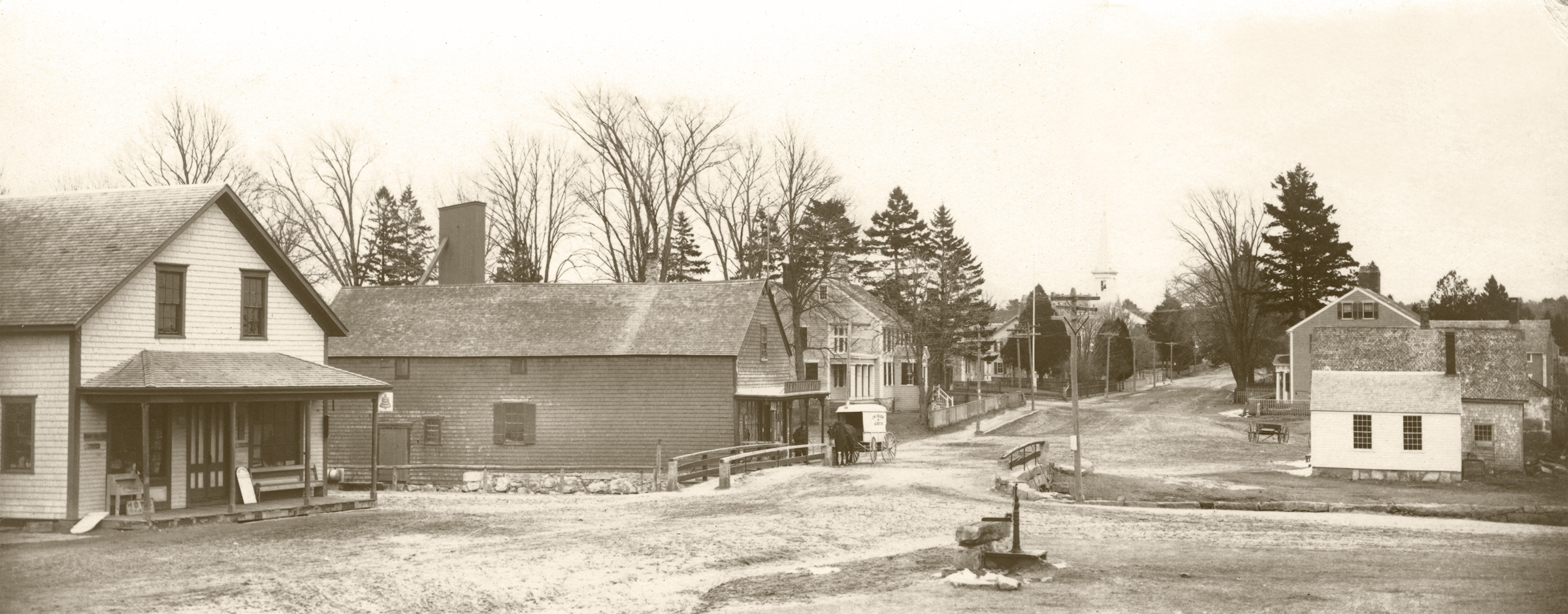
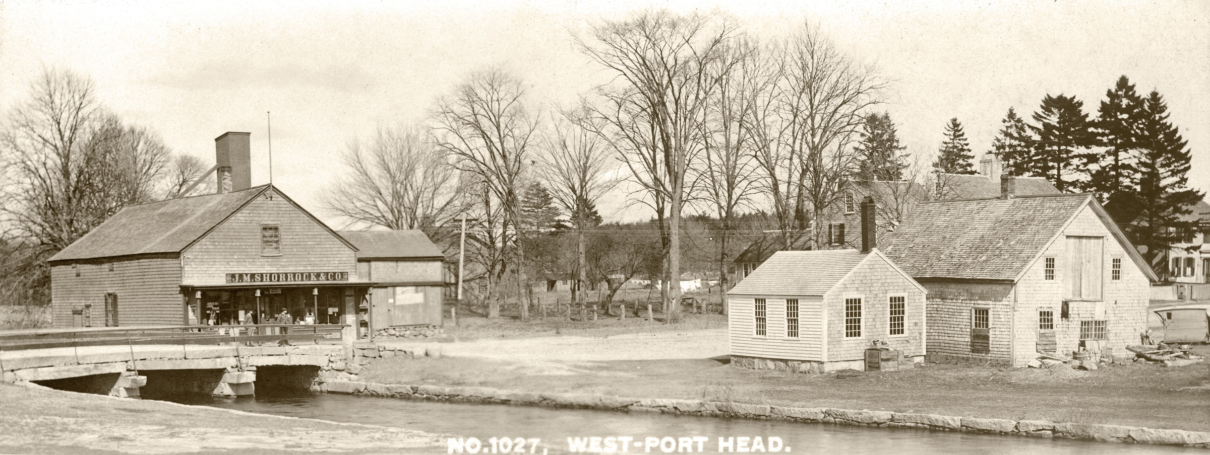
Views of the Stores at the Head of Westport Country stores were the heart of the community. In the early 1900’s, the Head of Westport was a thriving center for local businesses and general stores. On the east side of the river, stood J.M. Shorrock’s store (selling boots, paints, oils, varnishes, window glass, hay, grain and crockery) and on the west side stood Peckham and Howland’s store. A bridge has spanned the river here since 1790.

Views of the Stores at the Head of Westport Country stores were the heart of the community. In the early 1900’s, the Head of Westport was a thriving center for local businesses and general stores. On the east side of the river, stood J.M. Shorrock’s store (selling boots, paints, oils, varnishes, window glass, hay, grain and crockery) and on the west side stood Peckham and Howland’s store. A bridge has spanned the river here since 1790.
A View of the Bell School and Houses along Upper Drift Road at the Head of Westport A flag flutters from atop a flag pole outside the Bell School. On the left stands the Emanuel Thomas house, built in 1893. His brother “Manny” — a naval air force pilot — was notorious for buzzing the village in the 1930s with his biplane. In the 1970’s the property became the home and workshop of Robert Baker, a well-known wooden boat designer and Ann (Pete) Baker, a self-taught architectural historian who throughout her adult life saved more than 200 historic buildings in Westport and elsewhere. Three houses line Upper Drift Road, once known as Popple Ridge. Despite the passage of time, this view remains virtually unchanged today.
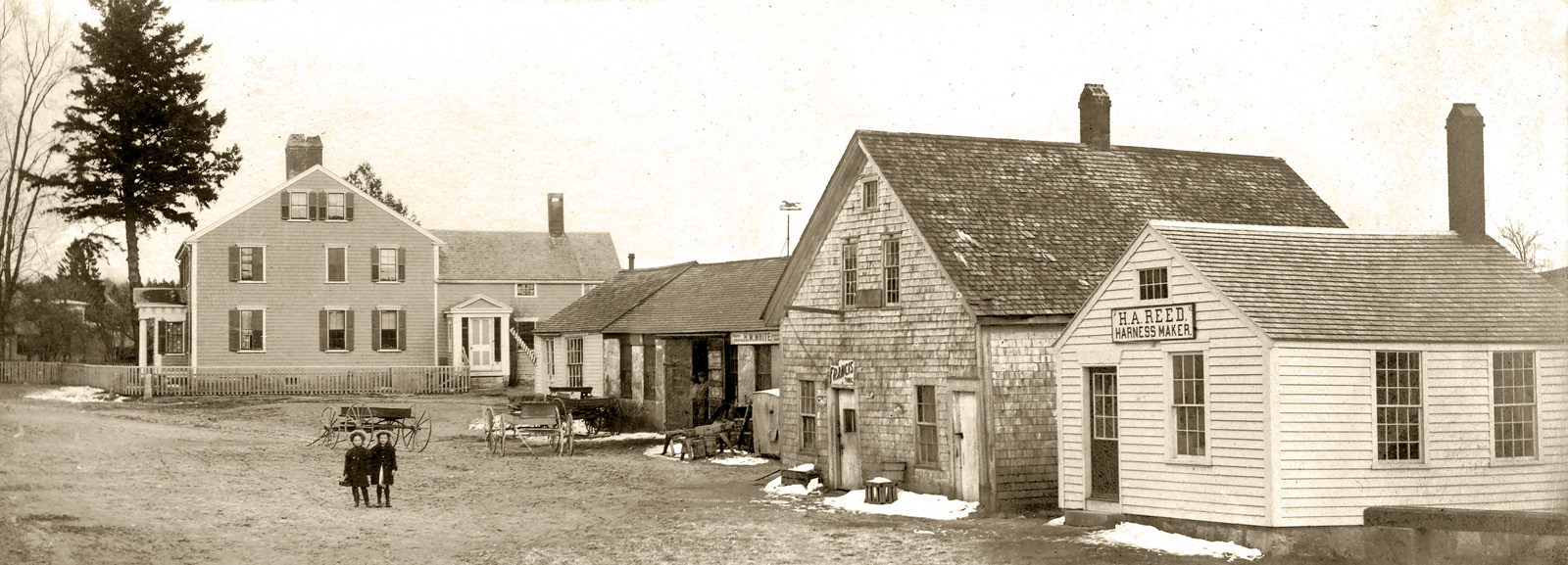
A View of the East Landing at the Head of Westport This view shows the current site of the Westport River Watershed Alliance headquarters. Their building was once the Head Garage, a car dealership and auto repair shop and a blacksmith shop. On the right stands Hiram Reed’s harness shop. On the left stands an iconic Georgian-style house, notable for its magnificent projecting front porch with Doric columns and pediment.
A View of the bridge and stores on Old County Road, Westport.
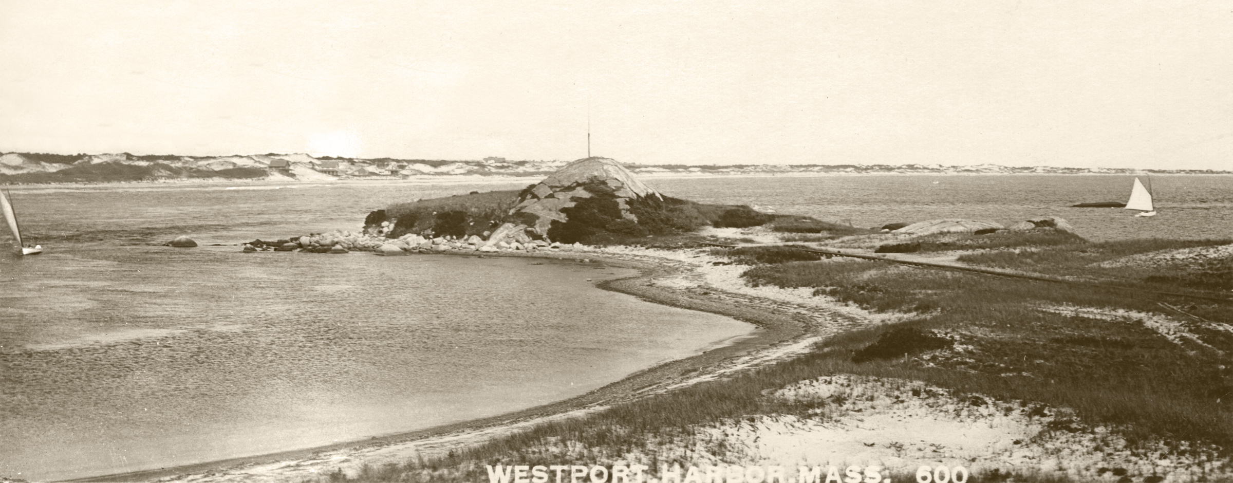
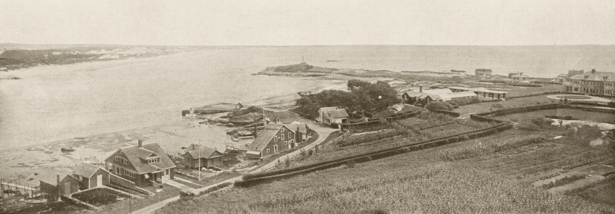
The Entrance to Westport Harbor A view of the Knubble with Horseneck beach in the background. Note the houses nestled in the dunes. In 1924 -1925, Franklin Delano Roosevelt stayed in one of these cottages with his close adviser Louis McHenry Howe. FDR spent his days sitting in a tent at the edge of the ocean, building model boats, and “working” on a movie script. In the afternoon FDR entertained friends with stories whilst sipping an orange blossom cocktail. The hidden harbor entrance once was known as The Devil’s Pocket Hole.
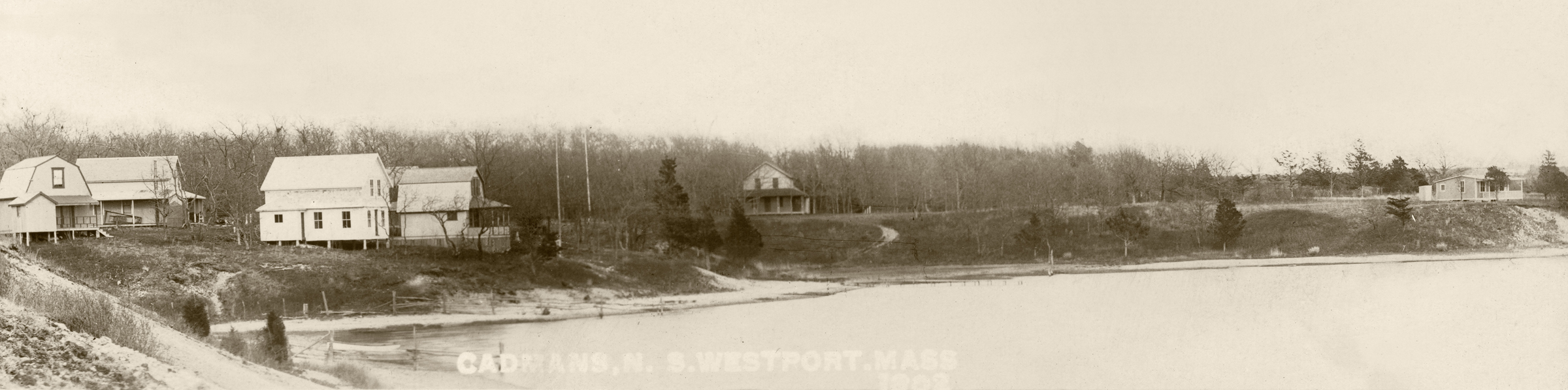
A View of Cottages on Cadman’s Neck Named after the early 18th century settler George Cadman, this small peninsula was once the site for camp meetings. Over time, it became a secluded summer destination, characterized by small and simple cottages.
Westport Point Bridge
A View of the Casino, Cockeast Pond and Westport Harbor Built at the southeast corner of Cockeast Pond in 1903, the Casino hosted Saturday night dances, theatrical performances, Sunday morning church services, clambakes and summer socials. Horseneck Beach can be seen in background On the left stands the Woodward House. Typical of the grand Harbor homes, it was built in the 1890’s by Stimpson Harvey Woodward, a wealthy businessman.
Bird’s-eye View of Acoaxet A pre-1938 hurricane image of Acoaxet taken from a water tower showing the formal grounds of the Charlton estate with green houses and pavilions, the Knubble, and larger homes along the shore line in the vicinity of Boathouse Row. On the left stands the Mathewson Boathouse, one of the largest boathouses. This area was significantly impacted by the hurricane of 1938 and many houses were destroyed.
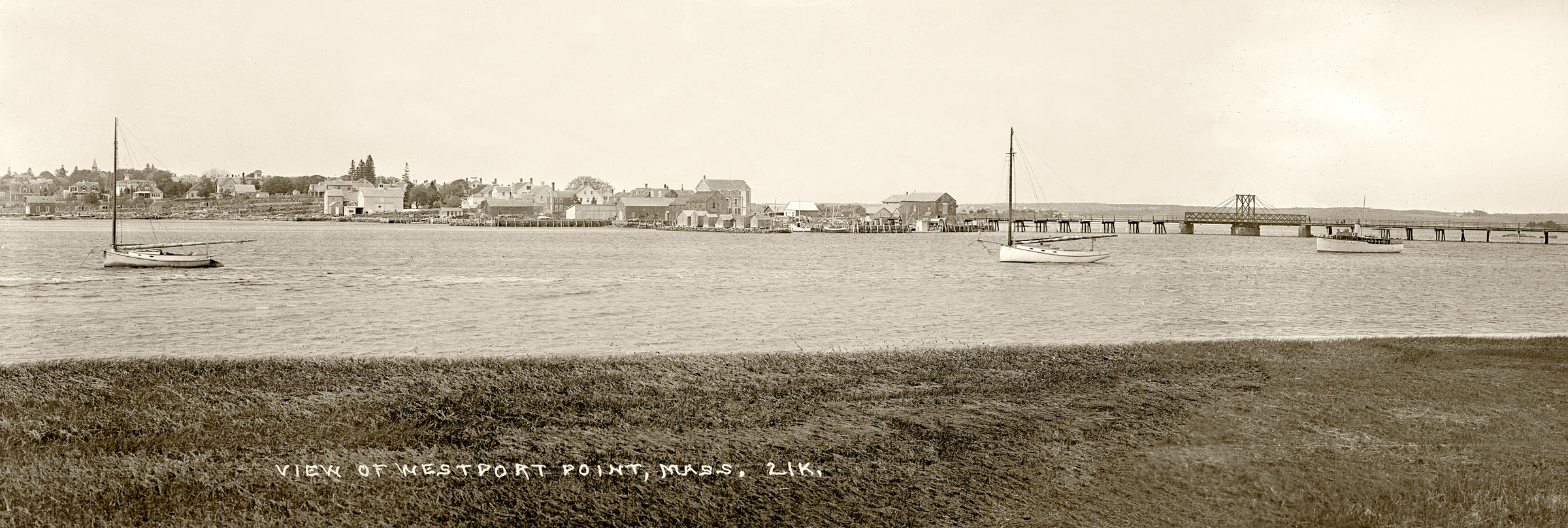
Views of Westport Point and the Old Bridge Image courtesy The Penobscot Marine Museum Collection, Eastern Illustrating and Publishing Company Collection. Dating from the early 1900’s, this view of Westport Point and the old bridge shows some familiar landmarks such as the Paquachuck Inn (originally the Cory Store) and many private homes that still stand along Main Road. A community defined by its location, the Point was the center for maritime activities. Blacksmiths, coopers, ship carpenters, sail and rope makers converged at the Point to service the needs of incoming and outgoing ships.